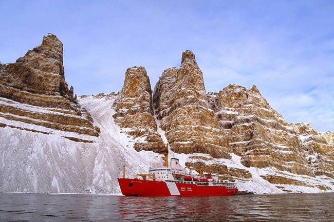
The USS Healy and the Canadian icebreaker Louis St. Laurent met in the faraway waters of the Beaufort Sea last week.
“The Healy is collecting information on the shape of the sea floor and we are collecting data on the thickness of the sediments,” said Jacob Verhoef, director of Canada’s Law of the Sea program in the Natural Resources Department.
“We both win in this sense because we both have equipment that the other doesn’t have at the same level,” said Verhoef, speaking from Halifax.
Riding the recent surge of interest by governments and petroleum companies over the utility and ownership of the Arctic, the second US-Canada joint survey signals each nation’s wish to resolve Arctic disputes through science and law rather than sword brandishing.
The ships will travel 3,000 kilometres in one of the most unmapped regions on Earth, taking snapshots of the Alpha Mendeleev Ridge, which runs along the northwest of Canada’s Arctic Archipelago, and the Lomonosov Ridge, which runs just under the geographic North Pole.
The goal is to find out whether these ridges are natural prolongations of the North American continent or a part of Eurasia, said Verhoef.
Onboard the Canadian vessel, which left Tuktoyaktuk August 7, 20 scientists from Natural Resources are preparing a massive air cannon that will take acoustic “pictures” of the sea floor by pulsing sound vibrations into the sea.
The echoes of these vibrations, which bounce off rock and muck 40 kilometres into the Earth’s surface, will be recorded by 63 microphones hung along a kilometre-long, 7.6-centimetre-thick tube.
The Healy will use sonar equipment to sketch a three-dimensional picture of the sea floor.
Together, these snapshots are the two pieces of the puzzle that both countries need to figure out their territorial limits in the Arctic.
It’s information Canada needs in order to submit its territorial claim to the United Nations Convention on the Law of the Sea by 2013.
The United States, which has signed but not ratified the convention, is currently looking at a plan to ratify the treaty, according to the New York Times.
The air cannon being carried by the 50-person Louis St. Laurent is smaller than the acoustic devices used by the oil and gas industry, said Verhoef.
“You really need a big vessel since we are operating in ice conditions that industry doesn’t usually operate in,” he said.
The kilometre-long recording tube is tougher than industry standards to withstand hits from floating ice.
“In industry terms, (the tube) is usually a system that is several kilometres long,” said Verhoef.
Natural Resources has already done 6,000 kilometres of Arctic seabed mapping in the last two years, and have been sharing their data with oil and gas companies looking for a foothold in the nascent Arctic fossil fuel market.
Divulging data to oil and gas companies is “a little bit of a sensitive issue right now” in terms of who gets the information and how early the government should spill the beans on where it thinks the borders will be, said Verhoef.
“On the other hand, it’s a trade-off because if you keep that data confidential for a couple of decades, it becomes useless because of the way technology and industry is evolving,” he said.
“We are trying to find the balance, but it’s not a hard and fast rule.”
The data usually gets published and presented at scientific conferences so that it can be peer-reviewed by experts, beefing up its credentials for the United Nations submission.
Verhoef attests to seeing oil and gas companies perusing Canada’s Arctic maps at conferences. As well, he spoke recently at an industry conference in St. John’s, he said.
“We don’t give preferential treatment to anybody, so anybody can get (the data),” he said.
The US Geological Survey estimates that 13 per cent of the Earth’s undiscovered oil and 30 per cent of its undiscovered natural gas lies under the Arctic seas, according to a 2008 report.
The rock under the Beaufort Sea is millions of years old and the most recent deposits are runoff from the Mackenzie River, said Verhoef.
A fourth survey mission will likely happen next year, he said.
“We have been very lucky that up until now our surveys have been successful,” he said. “So we are on track to finish the data collection probably by the end of 2011, which will give us two years to analyze it.”
The Law of the Sea convention was signed in 1982 and has been used internationally as a legal road map for marine territorial disputes since it became effective in 1994.
Russia and Norway have submitted their territorial claims, while Canada’s deadline is 2013 and Denmark has until 2014. These submissions are part of a lager process aimed at determining all undersea continental shelf extensions.
A blog (arctic-healy-baker-2008.blogspot.com) is posting photos taken every hour from the Healy’s bridge and is tracking both ships’ trajectories through the Beaufort Sea.
The Louis St. Laurent is expected to return to Tuktoyaktuk, NWT and the Healy to Barrow, Alaska, by September 16.
Contact James Munson at
jamesm@yukon-news.com