The drone of the motorboat was muffled by the roar of the rapids as we negotiated the Cleghorn Riffle on the Fortymile River. This is a deceptive piece of the river where the water is churned into metre-high waves by the boulder-strewn channel.
Larry Taylor, a veteran Alaskan guide and resident of the Fortymile, put us ashore to walk this stretch of the river while he navigated the 150 metres of white-capped water. The pamphlet provided by the US Bureau of Land Management hadn’t prepared us for the turbulence here, nor had it placed the riffle accurately on the map. Woe to the unsuspecting canoeist who would come around the bend in the river to confront this unfriendly water.
It was August 1998 and as a gold-rush centennial project, my friends Bill Berry, John Gould and I secured Larry’s expertise to take us on a journey through time and space. We had great confidence in Larry’s intimate knowledge of the Fortymile River, which spans the Yukon-Alaska boundary down to the Yukon River northwest of Dawson City.
Larry knew first-hand the dangers: on his first Fortymile trip many years before, he had lost everything going through a section of the river known as The Falls.
Bill, a retired California banker, was retracing the route of his ancestor Clarence J. Berry, who laboured up the Fortymile River to Franklin Gulch before the Klondike gold rush. I was curious to travel the route that I had described in my book Gold at Fortymile Creek. John, a historian from Dawson City, was there because of his natural curiosity and his voluminous knowledge of gold-mining history.
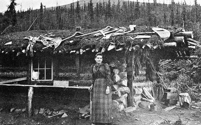
While never yielding the spectacular gold production of the Klondike River basin, the Fortymile was one of the most productive gold-bearing creeks discovered before the Klondike gold rush. The prospectors had given colourful names to every sandbar and tributary: Troublesome Point, Dogtown, Bonanza Bar, Wildcat Riffles, Deadman’s Riffles and the Cleghorn. Every name had a story.
The adventure we were on was the most profound for Bill, I think. His great-uncle Clarence eked out a living mucking for gold on Franklin Gulch before the Klondike. To make ends meet, Clarence was reduced to tending bar for Bill McPhee in his saloon in the small cluster of log buildings where the Fortymile River meets the Yukon.
McPhee grubstaked him, and he struck it rich on Eldorado Creek in the Klondike. Clarence repeated his luck at Fairbanks a few years later, and then trebled his good fortune when he invested in California oil.
But at the moment, the Cleghorn Riffle was on our mind. The early prospectors travelled this route by tracking or lining their goods upstream in boats. This demanding technique required at least two men, one to drag the supply-laden craft upstream with a rope while the other kept the stern out in the current with a long pole. The work was both tedious and exhausting.
It took days to haul the cargo from the trading posts at the town of Forty Mile to Franklin Gulch, about 140 kilometres upriver.
We were laden with guilt: where the old-timers struggled for days against the current, often immersed in frigid water to their hips, we were making the same trip in a few hours in a motorboat. The early day miners bivouacked on the banks of the river, battling weather and mosquitoes as they fought their way upstream.
In contrast, each night we were transported back to the Taylors’ tidy and comfortable home at O’Brien Creek, a tributary of the Fortymile, for a delicious home-cooked meal prepared by Larry’s wife, June.
After that, we could relax in the comfort of a sauna before retiring to one of the tidy cabins for a good night’s sleep.
The early-day miners lived and laboured in extreme isolation: a roundtrip exchange of correspondence could take up to eighteen months. Miners were so starved for news from the outside world that the newspaper wrapping in a parcel from Outside was literally worth its weight in gold.
The prospecting and mining work was all done by hand in those days. Three miners hand sawed 50,000 feet of lumber for a flume to divert water a kilometre and a half from Franklin Gulch to their claim on Troublesome Point. Another partnership did the same, earning seventy-five dollars per day for their efforts, an excellent return on their investment for that time.
It was on the Fortymile that they perfected the technique of drift mining, which enabled a miner to thaw and dig his way down to bedrock through frozen ground in the winter. It was a dramatic improvement over remaining idle all winter while awaiting summer’s return.
Drift mining was later employed extensively in the Klondike.
In 2003, I took a second trip down the Fortymile in large inflatables with a team of cultural resource specialists. It had been a hot, dry summer. This time the water was so low in the upper portion of our journey that I waded across the main channel in rubber boots. We dragged our craft over numerous shallows and floated slowly along.
At The Falls, where the river drops almost three metres in a short distance, we floated gently through. What a different experience from my previous journey when Larry Taylor navigated it at full throttle.
We never did negotiate the most dangerous portion of all: the Canyon Rapids on the Canadian side of the border.
The Fortymile flows gently past a cabin at Long Bar. If you come ashore here, you will find a small memorial for two people who died in the Canyon Rapids around 1980. Two couples, one of whom lived in that cabin, tried to make it through the canyon during high spring runoff.
One member of each couple lost their life, and the lovely log cabin at Long Bar, now abandoned, became a symbol of a spoiled dream.
Until the prospectors learned the stern code of the Fortymile, the river and its canyon took many lives. The year following the discovery of gold was particularly deadly. The first to drown was a prospector named Tom Jones, who was stranded on a boulder in the canyon only six metres from shore and tried to swim, thinking that he could reach it safely. He was caught in the deadly undertow and sucked below the frothing currents.
After Jones, the toll quickly mounted and the names Lamont, Saffron, Johnson, Holmes and Wells were added to the death roll, but most tragic was the account of a Gwitchin man who, after capsizing in the canyon and mistakenly thinking that his entire family had perished, cut his own throat.
While encounters with the past are my main goal as a history hunter, safety remains paramount. After all, I’d like to be around to do it again.
This column is reprinted from the book History Hunting in the Yukon, which is available in stores throughout the Yukon. Michael Gates is a local historian and sometimes adventurer based in Whitehorse.