The route that became known as the Dalton Trail was long used by the Chilkat people from the coast of Alaska to trade with the people of the southwest Yukon and beyond. It was first captured on a paper map, drawn by Chilkat leader Khoklux in 1869 for American geographer George Davidson.
By the late 1890s, the traditional control of the trading rights on the Chilkat Pass by the Tlingit people had been usurped by American pathfinder and entrepreneur, Jack Dalton. For a brief period, during the gold rush, this trail was an important route to the Klondike and was re-named the Dalton Trail.
To the long-time First Nation residents of the country, however, the place is still imbedded with stories and traditions.
Dalton’s trail started at Pyramid Harbor, on the west side of Chilkat Inlet, where ships and barges from southern Canada and the United States disgorged their cargoes and cattle headed for Dawson City. The settlement included a salmon cannery, a small cluster of cabins and tents, and a Chilkat village. Corrals along the shore sometimes held hundreds of animals while they were waiting to be moved into the Yukon.
The trail north first led below the mountain face along the tidal flats to the broad flat flood plain of the Chilkat River. Jack Dalton invested a considerable sum of money laying corduroy on the trail, clearing brush and building bridges, and he charged everyone who used his trail a fee, including the Tlingit people who had used this route for centuries.
Dalton placed a toll booth on the east bank of the Takhini River, then later at a place called Murphy’s Flat. A toll was charged for every head of livestock and pound of freight carried over the trail.
The station consisted of a pole extending across the trail, and a shack beside the trail with one of Dalton’s henchmen waiting to collect the fee. According to one account, there was a big sign hanging there, stating the prices charged for each horse and head of cattle that went over the trail. To make a point, a gun cartridge was driven into the sign to punctuate one of the sentences.
Beyond that place were a number of stopping points along the trail that were born overnight and abandoned almost as quickly: Walkerville, a sawmill and small cluster of tents; Camp Sunshine (or Sunrise), which was shaded from the sun by the surrounding mountains, and Salmon City, with its temporary sawmill.
Porcupine, on the gold-bearing creek of the same name, proved to be the most productive and long-lived settlement on the Alaskan side of the border. Then the Dalton trail snaked across the gravelly meandering flat valley bottom, eventually crossing over to the eastern side of the valley.
Just up river from the Tlingit village of Klukwan (which was the traditional Tlingit starting point of the trail), at the confluence of the Chilkat and Klehini Rivers, was the settlement of Troy, and a short distance from it on the Chilkat River was the North West Mounted Police post of Wells. For a few years, Wells was the tentative international boundary point on the trail.
Pleasant Camp, located at the modern-day border crossing, which consisted of a quadrangle of impressive log buildings, was the headquarters of the North-West Mounted Police on the trail. This place has now disappeared into the dense coastal rain forest.
Dalton Cache, which was operated by Jack Dalton, was within spitting distance of the Mounties’ post and has been restored in an attractive setting behind the US Customs station.
Another Mounted Police Post was established 100 kilometres to the north beside Dalton’s trading post and warehouse on the Tatshenshini River, at the mouth of Klukshu Creek. Dalton established it a short distance from the seasonal Southern Tutchone trading settlement of Neskataheen, which consisted of a cluster of two dozen or so impressive log structures built in the fashion of the coastal Tlingit long houses. This was the most impressive settlement along the 450 kilometre-long trail.
Kluskshu village lay at the point where Kluskshu Lake empties into the creek of the same name. Diverging from the main trail here was a side trail that led to gold prospects on Alder Creek that were tested during the height of the gold rush in 1898.
According to oral tradition, a long time ago, a man named Akh Jiyish was hunting a moose and it got away, so he followed it until he came to a small stream, in which he saw a new kind of fish - salmon. He took the news back to his people and in the morning they returned with him to the location he had just discovered.
There, they found the fish were in such abundance that they moved their camp and the village of Klukshu came into being.
According to another traditional account, Akh Jiyish was a member of the Wolf moiety, and this creek belonged to the Wolf people, until, on a hunting trip, he killed his brother-in-law for killing all the game in the area.
To balance the ledger in this matrilineal society, the son of Akh Jiyish was to kill his father to avenge the death of his uncle, but seeing the grey hair on the older man’s head, he couldn’t do it. He killed a slave instead, and then, in partial compensation, Akh Jiyish transferred the fishing and hunting rights in the Dezadeash River and Klukshu area to the Crow people.
In a culture through which knowledge and social traditions are passed on by word of mouth, stories like those above, recorded from elders Johnnie Fraser and Jessie Joe by anthropologist Catharine McClellan, contain great value and importance.
They were told before Europeans arrived, and are retold to the present day.
The main trail led along the Dezadeash River, then north to the village of Hutchi. Between the two points were a number of log buildings constructed by a prospecting syndicate that explored the region in 1898. These buildings included Pennock’s Post, and Camp Storey, which have long since been abandoned, and Champlain’s Landing, which later became Champagne, and the site of a trading post and village on the trail from Whitehorse to Kluane Lake.
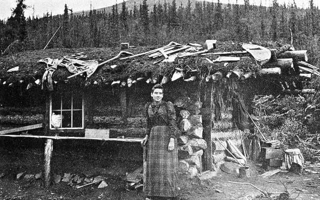
Hutchi, situated beside the third of a string of small lakes, consisted of a number of native houses, a cemetery, and a poorly-stocked trading post operated by Jack Dalton out of a tent. The First Nation population here in 1902 was estimated to be two hundred people.
The last developed stopping point along the trail, and the north end of the route was the Mounted Police Post at Five Finger Rapids, which consisted of a small cluster of buildings, and a sawmill.
Most of these sites have long since been abandoned and have returned to nature. A few of them, however, survive and flourish to testify to life and activity along a route once important for trade and commerce, both to Europeans and First Nations.
Michael Gates is a local historian
and sometimes adventurer
based in Whitehorse.