OK, now isn’t the best time for your Yukon vacation. Every person entering the Yukon is required to self-isolate for 14 days, and the Canada-US border is closed to non-essential travel. But the world will open up eventually, so why not start planning your Yukon travel today?
The Yukon is filled with scenery that feels like it’s from another planet — sparse, sturdy tundra, fields of exposed granite and waterfalls, dazzling aurora borealis… plus Canada’s highest mountains, mighty rivers and all of the country’s most fantastic beasts. The best way to see it all is a road trip, and the Yukon has no shortage of epic highways.
Remember: driving in the Yukon takes preparation! Expect blizzards in winter, dust in summer, mud in spring and limited cell service. Download maps and other info before leaving the hotel, and watch for wildlife, especially when daylight is limited between October and March.
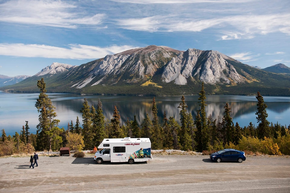
1. Alaska Highway
- The route: From Dawson Creek, BC through Whitehorse, YK to Delta Junction, AK.
- Pitstops: Drive the Alaska Highway for dramatic scenery, but also the weird and wonderful Northern towns along the way. Visit Watson Lake Signpost Forest to connect with the region’s rich history of roadtripping and the highway’s construction in the 1940s. Take a quick detour to Carcross Desert (yes, Yukon has a desert), or keep going to Skagway, Alaska for a taste of the gold rush at the Red Onion Saloon, built in 1898. Fill up on culture in Whitehorse with museums and fantastic foodie cuisine, then check out Kluane National Park & Reserve for sky-high peaks and Canada’s largest ice field.
- Know before you go: The Alaska Highway used to be notoriously rough on vehicles, but is now paved from end-to-end. It’s still a good idea to keep the fuel tank topped up, and drive with caution to avoid wildlife and potholes.
READ MORE: Take a hike: Popular Yukon Hiking website becoming hardcopy guidebook
READ MORE: History Hunter: Beatrice Lorne — The ‘Klondike Nightingale’
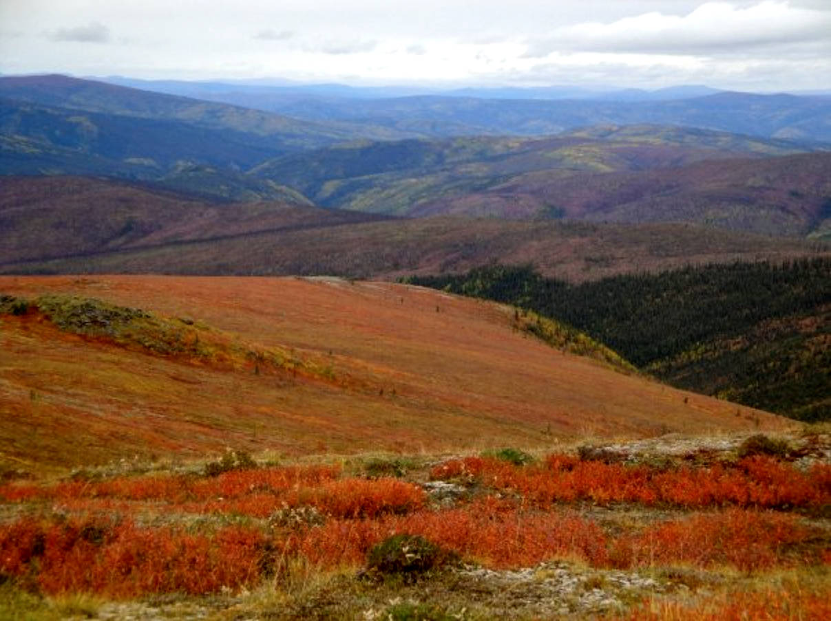
2. Top of the World Highway
- The route: Dawson City, YK to Tok, AK.
- Pitstops: The Top of the World Highway lives up to its name, winding along the ridgeline from peak-to-peak with expansive views of rolling hills and dwarf shrubs. It’s a jaw-dropping trip, but there aren’t a lot of pitstops on the four-hour journey. Pull off often to take in the view, then relish the one-of-a-kind customs experience at the Northernmost Canada-US border crossing (boasting a population of two when I passed through in 2009). Stop in the town of Chicken, Alaska for fun souvenirs and a bite to eat, then make your way to Tok before the sun sets. Short on time? The views are spectacular just 16 minutes from Dawson City, and just get better from there.
- Know before you go: The highway is only open from mid-May to mid-October, and may close earlier due to snow. Sections of the road are paved, but much of the highway is smooth gravel. Carry more than enough fuel for the entire route.
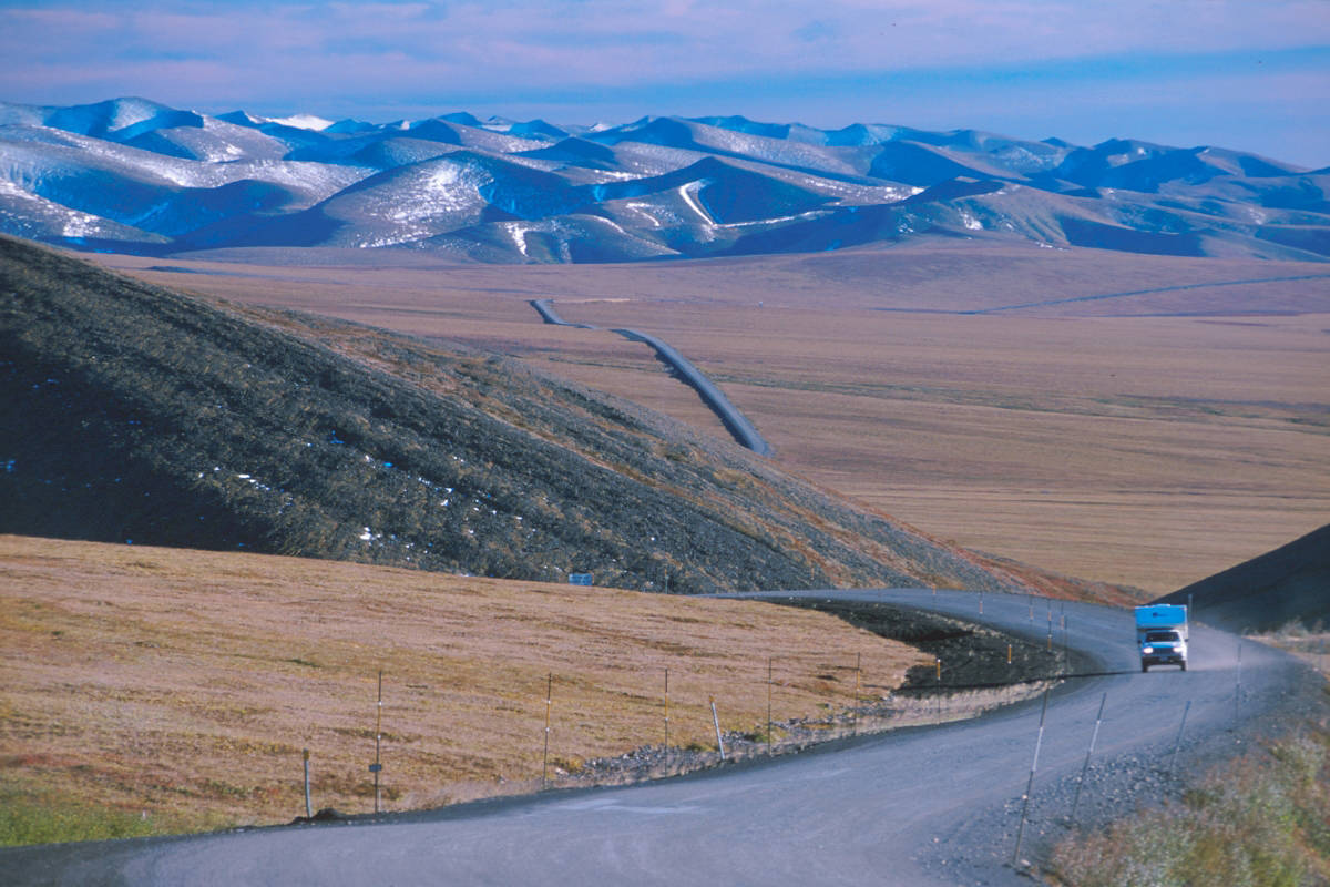
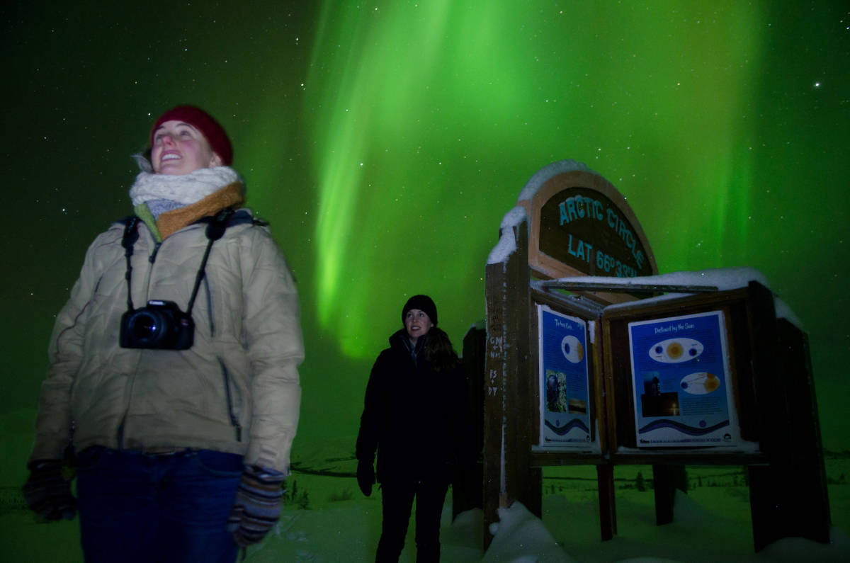
3. Dempster Highway
- The route: Dawson City, YK to Inuvik, NWT
- Pitstops: When you really want to get away from it all, you can’t get much better than the Dempster Highway. No cell service, one town, and 800 kilometres of wilderness. Plan to take time for short hikes to see foreboding Tombstone Mountain, the limestone spires of Sapper Hill, the obligatory selfie at the signpost when you cross the Arctic Circle, and the other-worldly tundra north of 60. Go in summer to experience 24-hour sun, or in winter to hunt the aurora. Though services are limited along the Dempster Highway, there are plenty of campgrounds to extend your stay. Eagle Plains marks the mid-way point, and is your best bet to re-stock essentials.
- Know before you go: Supplies are scarce on the Dempster, so it’s essential to plan ahead. Make sure you have a spare tire (or two), a full tank of gas and at least one extra gerry can. Pack plenty of food and appropriate clothing in case inclement weather rolls in. The road is gravel, but you don’t need a specialized vehicle — just one that’s in good mechanical condition!
READ MORE: Winter driving: 3 tips for better road trips
READ MORE: 3 Wild Yukon excursions for your dog sled bucket list