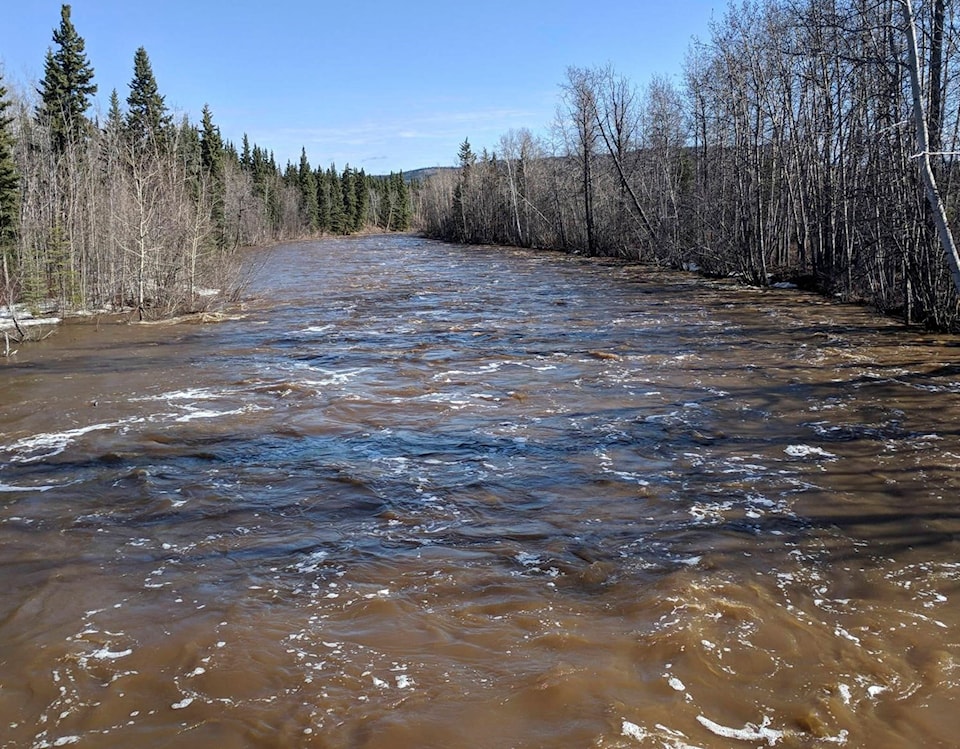
There has been a high streamflow advisory issued for two Yukon rivers – the Nordenskiold River and tributaries of the Yukon River around Carmacks and the Klondike River and tributaries of the Yukon River around Dawson City.
Following the river-ice breakup, flows have continued to rise on these systems, according to a release by the Emergency Measures Organization and Water Resources Branch.
Flows are expected to remain high, or rise, in the coming days as overnight and nighttime temperatures remain above zero, while daytime temperatures have been in the mid-to-high teens.
The Nordenskiold may continue to rise depending on the remaining snowpack. Current levels are above the mean annual flood – the level expected every two years.
The water levels peaked May 11 following light rain. The levels are expected to stabilize in the coming days, however, they remain high.
The Klondike River may see moderate rain over the next several days in combination with overnight lows above zero.
Flows are expected to continue to rise.
Rock Creek water levels are being monitored closely to determine if the High streamflow advisory should be upgraded to flood watch.
Advisory and warning levels
High streamflow advisory means that river levels are rising or expected to rise rapidly, but no major flooding is expected. Minor flooding in low areas is a possibility.
Flood watch means that river levels are rising and will approach or exceed bankfull. Flood areas are adjacent to affected rivers may occur.
Flood warning means that river levels have exceeded bankfull or will exceed bankfull imminently and that flooding of areas adjacent to the rivers will be affected.
Steer clear
The public is advised to avoid the fast-flowing rivers and unstable river banks during the high streamflow period.
Property owners prone to flooding are advised to have a plan in place in the event of a flood.
Conditions will continue to be monitored and updates proved as conditions change.
What else is happening?
On May 13, the Yukon government released its May Snow Bulletin. Based on the information provided, Yukon Energy updated its forecast for peak water levels in each of the watersheds that feed their reservoirs.
The forecast continues to predict higher than normal water levels on Marsh Lake. The model suggests that the lake will peak at 656.78 metres this summer – that is 56 cm lower than peak water levels during the 2007 flood.
The Yukon Water Board approved Yukon Energy’s application to lower levels on Marsh Lake by 10cm lower than the low supply level permitted in their water use license. However, because of early spring melt, it is unlikely the reduced level will be reached this spring.
Spring melt entered the lake around May 7 or two weeks earlier than normal. Since March, the water levels at Marsh Lake have been lowered by more than 1.25 metres.
Contact John Tonin at john.tonin@yukon-news.com