Authorities in British Columbia have ordered an evacuation of Lower Post, located near the Yukon border, due to a fire burning to the south of the community.
The evacuation was ordered on the afternoon of Aug. 21 and triggered by the growth of the Lutz Creek fire, which is an estimated 4,000 hectares in size and is burning about five kilometres south of Lower Post.
Yukon’s Protective Services said in a tweet Aug. 21 that evacuees will be welcomed at the Watson Lake Recreation Centre.
Watson Lake, which is about 20 kilometres northwest from Lower Post, is dealing with at least two fires burning nearby, although the town is not under threat from the flames.
As of the morning of Aug. 22 the Alaska Highway was closed from kilometre 980 at Watson Lake to the Yukon border.
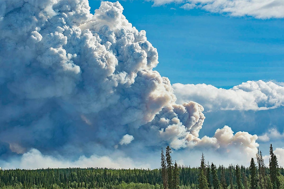
Smoke is becoming “increasingly visible” in Watson Lake due to the Poison Lake and Iron Creek fires as well as two fires burning near Lower Post, according to an Aug. 20 bulletin from the Yukon’s Wildland Fire Management service, and as of 5 p.m. on Aug. 21, kilometres 30 to 60 of the Robert Campbell Highway were closed to traffic due to fire activity near the roadway.
An evacuation alert is also in effect for kilometres 44 to 60 of the Robert Campbell Highway due to increased activity from the Poison Lake fire.
Recent hot temperatures and dry weather has increased the Poison Lake fire’s activity, the Aug. 20 bulletin says, and with anticipated westerly winds, the fire may continue to impact the Robert Campbell Highway in the coming days. The Poison Lake fire is estimated to be 24,465 hectares in size.
The Iron Creek fire is an estimated 800 hectares in size and is burning in the wilderness about four kilometres north of the Alaska Highway, according to the bulletin. It is currently not threatening the highway or structures in the area, but is “highly visible from the highway,” the bulletin notes.
Meanwhile, in the Southern Lakes region, the Windy Arm fire is an estimated 1,250 hectares in size. A Wildland Fire Management update Aug. 21 said the “highly visible” fire is not a threat to the communities and infrastructure in the area, noting that there’s been “minimal growth” and that air tankers and helicopters have been responding.
Wildland Fire Management fire and public information officer Breagha Fraser said that as of Aug. 21, there are no plans to recall any of the 27 Yukon fire staff who were sent to assist crews in British Columbia with the fires currently burning across the province.
As of 5 p.m. on Aug. 21, there were 32 active wildfires in the Yukon.
Contact Jackie Hong at jackie.hong@yukon-news.com