The final consultation on the recommended Dawson land use plan begins Sept. 20 and will wrap up on Nov. 20.
Unlike previous engagements, this time it’s the two governments — the Trʼondëk Hwëchʼin government and the Yukon government — who want to know what people think.
The Dawson Regional Planning Commission officially finished its work with the June delivery of their recommended plan to the two governments. On Sept. 7, the plan was made publicly available and now the finalization process begins with one last stage of consultation.
People wanting to participate can download one of three documents — an eight-page highlights report, a 37-page summary, or the full 357-page report. All three versions and the survey are available at onthelandwewalktogether.ca. Community meetings will be held in Dawson, Whitehorse and Mayo until Nov. 20.
This iteration of the Dawson land use planning process started in 2018 with a new commission and a new terms-of-reference, after an earlier attempt faltered and was then delayed by the Peel Watershed Plan moving through court proceedings.
After extensive information gathering, the commission released a draft plan in June 2021 and a comprehensive consultation process followed.
Throughout the remainder of 2021, the Dawson Regional Planning Commission met with about 30 stakeholder groups in the area, in addition to workshops in Whitehorse and online.
Over 1,000 pages of notes and comments were received and incorporated into the latest draft, Tim Sellars told the News on Jan. 3. Previously the senior planner for the Dawson commission, Sellars is now the director of the Yukon Land Use Planning Council.
Sellars was heartened at the level of interest and believed that the collaborative planning model would yield benefits to the planning process. He was also surprised at the level of concern received concerning climate change impacts on habitat and fauna.
The commission released a What We Heard report and then drafted final recommendations.
For Sebastian Jones of the Yukon Conservation Society, the plan’s biggest shift expanded Special Management Areas (SMAs).
SMA designation means an area is recommended for permanent protection against new industrial development, new surface access and new mineral staking, though existing mineral activity can continue. The area would be legally protected with management plans.
Jones believes the original draft plan was hesitant to use the SMA designation.
“They’ve changed their mind that protected areas actually can be useful, and so, we now have this designated 34 per cent,” he said.
Tombstone Territorial Park is within the region but outside of the scope of the planning and constitutes another 5.3 per cent of the area.
“That’s the big change,” Jones said.
The Yukon government moved to temporarily prohibit mineral staking on June 15, 2021, and later extended the prohibition to December 2023, pending final recommendations, according to a department of Energy, Mines and Resources spokesperson on Sept. 20. The current interim prohibition extends to 47 per cent of the area, not including Tombstone or community areas.
In addition to the SMAs, three areas have been set aside for sub-regional planning — the Yukon River corridor, Klondike Valley and the Dempster Highway corridor — due to a range of complex considerations. The plan also identified two areas that need specific plans before mineral staking can resume — Upper Indian River Wetlands and Antimony, an area bordering Tombstone and Brewery Creek.
The commission also called for the parties to prioritize the development of access management plans in areas where a high degree of overlap exists between caribou habitat and development activities. The plan refers to stewardship often and uses phrases like precautionary principles and adaptive management to allow plans to make any needed accommodations. Ground disturbance thresholds are used to calculate cumulative effects.
Regional land use plans are an obligation of the 1993 Umbrella Final Agreement. Seven regional planning areas have been identified, and only two plans have been completed. The completion of the plans falls to the Yukon and First Nation governments, but the costs are born by the federal government. The Dawson regional land use plan, when accepted by the Yukon government and the Trʼondëk Hwëchʼin First Nation, will be the third.
Regional land use plans are a complex accounting for a wide range of values and interests, everything from mining to heritage to wetlands and food security. Sellars said that as part of the initial gathering of information, resource assessments happened alongside and led to a huge document.
“The resource assessment report is a huge compilation of all the knowledge and maps and information about everything from conservation values, to mineral values, to cultural values and heritage values,” he said.
“It’s a very thick report, but it’s really, really important towards making informed decisions.” That document was compiled in 2020 and fed into the 2021 draft report.
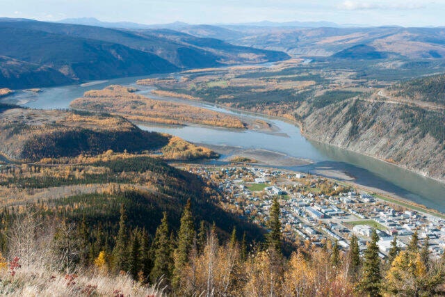
The three goals of the process were labelled ecological, socio-cultural and economic originally, then ‘socio’ was added to the economic goal in the recommended plan. Prime amongst the ecological considerations were caribou and wetland preservation, both of which tend to overlap with placer mining. Placer mining, with the highest activity for land approvals in the Yukon was high on the economic interests with quartz interests looming large due to future interests in Coffee Gold. Culturally, the Yukon River corridor was of paramount importance due to salmon and heritage sites and traditional activities.
Jones believes that the activities already on the ground did tend to form the basis of the plans. He said there were areas where caribou needed to be protected, but since the area was already staked, caribou habitat protection was not put in place by the planners.
Sellars said he had anticipated some conflict in discussions, but instead experienced an amazing amount of respectful, thoughtful and articulate feedback throughout the process.
Jones agreed, saying that the commission had done a terrific job working with people and interests during the construction and completion of the plans.
Contact Lawrie Crawford at lawrie.crawford@yukon-news.com