The Klondike River is under a flood warning, which is an upgrade from a watch, according to the latest advisory from the Yukon’s emergency coordination centre.
As per the May 24 update, another “tactical evacuation” — which is not mandatory — of Rock Creek near Dawson City is happening as snowmelt and recent rain is causing the river to rise.
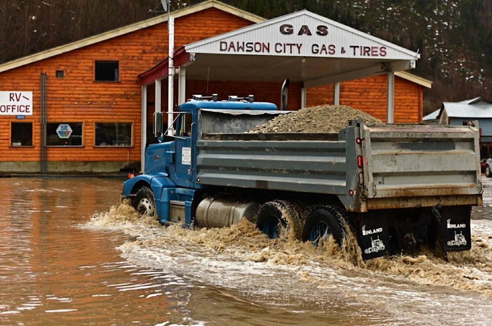
Water levels in Rock Creek and the Tr’ondëk Hwëch’in farm are close to levels experienced during the previous ice jam flooding from earlier this season, the update states. The water levels may go up more and the water is expected to peak on May 24. The water may stay above the flood threshold or near it as precipitation continues over the coming days.
READ MORE: Rock Creek evacuating; Trondëk Hwëchin farm fighting off Yukon’s Klondike River flooding
The Yukon government is working with local partners to respond. In the update, people are advised to be cautious and vigilant around the Klondike River. Residents that had to leave their homes can register with emergency support services for assistance with accommodation and other supports by calling 867-332-4597 or go to the website.
A portion of the North Klondike Highway continues to be closed between Stewart Crossing and the Dempster corner between kilometres 536 to 674. High water at the Clear Creek bridge is “impacting the safety of the highway and the bridge itself,” according to a late afternoon update via the Yukon’s Highways and Public Works department on May 24. The update indicates there is no timeline for reopening the highway.
“While we are doing our best to open the highway to traffic, this may be a multi-day closure until water levels drop and we ensure the bridge is safe for use,” reads the update.
“Please avoid travel to this area. For your safety, do not drive past the barricades in place.”
The Dempster Highway is closed between kilometres 237 to 286 due to washouts, the update states.
Water is overflowing from ditches over the Silver Trail, the road in and out of Mayo. The update cautions road users in the area. High water may also be affecting the northeast side of town as the Yukon government is operating pumps on the dike road in attempt to lower the water level.
READ MORE: High waters, washouts stoke North Klondike, Dempster highway closures
A high-streamflow advisory has been maintained for the Pelly River at Ross River. In the May 23 advisory, the river peaked on May 22 and is showing signs of stabilizing. Water levels are anticipated to recede by the end of the weekend with no major rain events in the forecast.
A flood watch has ended for the Nordenskiold River at Carmacks and a high-streamflow advisory is no longer in place for the Porcupine River at Old Crow, as of May 23.
Contact Dana Hatherly at dana.hatherly@yukon-news.com