If the folks at the White Pass and Yukon Route Company had their way more than 100 years ago, Whitehorse wouldn’t have been Whitehorse at all.
It would have been Closeleigh, Yukon.
Company officials wanted to name the settlement Closeleigh after the Close brothers, their financiers.
But community members were having none of it.
Before it was officially named, the place was commonly known as White Horse. That was an acknowledgement of the white-capped waves around Miles Canyon that looked a little like the white manes of running horses.
The spot was officially named White Horse in 1900. The two words were eventually combined in the style we know today in 1957.
There is a story behind every name in the Yukon and the latest show presented by the MacBridge Museum of Yukon History attempts to gather them all in one place.
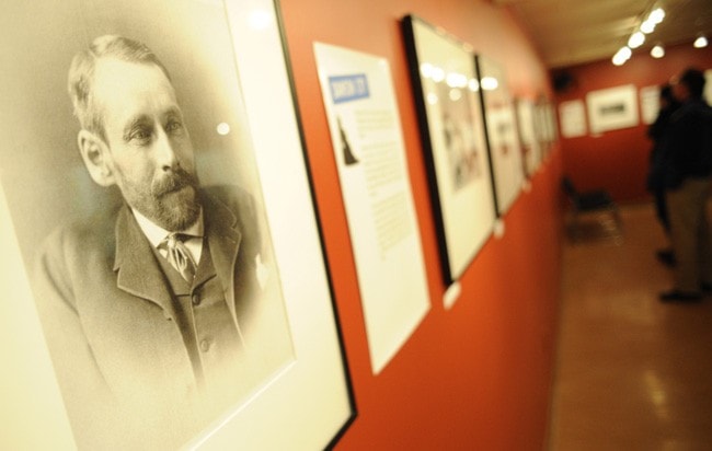
What’s in a Name? explores how 15 of Yukon’s communities came to be called what they are today.
The exhibition runs until June in the Hougen Heritage Gallery at Arts Underground.
“Everything we do at the museum, we try to allow for Yukoners to see themselves reflected back in what we present,” said co-curator Stephanie Webb.
“Hopefully, for people that see it and are from the communities it can help them trigger memories. And for visitors, (it will allow them) to have an understanding of an aspect of these communities.”
At the exhibit, a short written explanation for each community’s name is accompanied by photos that come mostly from the museum’s massive collection.
The MacBride museum has an overall collection of nearly 30,000 items made up of a range of artifacts, letters and, of course, photos.
“The idea was to find photographs that reflect stories of the towns and the history of their names and/or are representative of the town,” Webb said.
The photo picked for Faro shows the mine in 1970 at 3 p.m. with the sun setting.
The museum’s research found that Faro was likely named after a card game that was popular during the Klondike gold rush. It’s rarely played anymore but was simple to learn if you had two decks of cards.
The story behind Destruction Bay is as colourful as you might imagine.
The community as it sits today started out as a camp for U.S. Army engineers building the Alaskan-Canadian Highway in 1942.
Once the camp was built, high winds picked up.
Most of the buildings were destroyed.
Each community in the Yukon is represented in the exhibit with the exception of Beaver Creek and Old Crow. Webb said the museum did not have photos to do justice to those communities.
This is not the first time the museum has explored the history of names in the territory.
Late last year staff used land surveys, historical photographs and biographies to explore the stories behind the street names in downtown Whitehorse.
“The previous show that we did was Paved with Stories looking at the history behind the names of the streets of Whitehorse. (This is) taking that one step further and expanding it over the territory,” Webb said.
Names “tell you who was there, and who stayed there,” she said.
Webb is hoping a visit to the exhibit will allow Yukoners to take away “a sense of place, definitely a sense of place,” she said. And for visitors, “Curiosity. I hope it peaks their curiosity as well.”
The exhibit is free.
Contact Ashley Joannou at
ashleyj@yukon-news.com