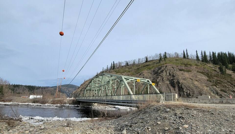
Flood fears on the Klondike River near Dawson City are subsiding as a concerning ice jam has been flushed down to the Yukon River.
Notices from the territorial government and the city of Dawson issued around noon on April 30 suggest that the icepack at the Klondike River Bridge that prompted concerns in recent weeks has broken free, leading to a roughly 1.7-metre drop in water levels in the area. The accompanying flood warning, high streamflow advisory and evacuation alert have all been rescinded.
Local governments and the people of Dawson and the Klondike Valley had been tooling up for some sandbagging, but the City of Dawson is now saying no volunteers are needed.
The message from the city also notes two small ice jams still in place upstream of the one at the bridge. One is at Henderson Corner, and the other is near the Bear Creek subdivision. The message states that small rises in water levels may result when these jams release, but it is not presently a concern.
The government notice about the reduced flood risk notes that once the river is open, with the remaining ice gone and snow beginning to melt, water levels will rise with the seasonal freshet.
Also notable in the region is that the breakup on the Yukon River through Dawson is expected to occur within the next three days.
Yukon government protective services representative Julia Duchesne said that along with the situation in the Klondike Valley, the other area being closely monitored is the Porcupine River around Old Crow. The area is being watched closely due to well-above-average snowpack.
The territorial government’s flood atlas, which hosts its forecasting regarding river flow and flood risk, notes that temperatures in the Porcupine basin are expected to remain below freezing through Friday before rising somewhat.
“There are no significant high temperatures in the long-range forecast, but a gentle warming trend and then steady temperatures near seasonal is expected. The forecast should promote gradual melting over the coming week. This is the ideal temperature trend for reducing flood risk,” the flood atlas page reads.
(Jim Elliot)