City planners have big plans for the south-end of downtown Whitehorse.
The aptly named Downtown South Master Plan is the result of exhaustive study and consultations with developers, architects, engineers, designers and the public.
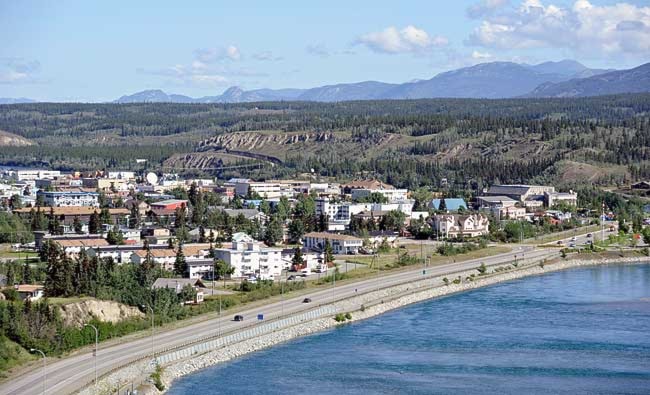
A draft of the plan, presented to council on Monday, would transform the vacant area into a high-density residential neighbourhood over the next two decades.
A paved trail would be built along the bottom of the escarpment.
Starting at Lambert Street, it would run past new parks, art installations and a staircase that would lead to the top of the escarpment.
The trail would empty out at Robert Service Way near the Millennium Trail.
It would create a looped trail that would encircle the entire south end of downtown.
Along Sixth Avenue there are plans to build mixed residential/commercial spaces and extending and improving streets like Rogers to Hoge.
Attempts would be made to slow traffic along Robert Service Way with landscaped medians from Sixth Avenue to Rotary Park.
The entire stretch of road would be rebilled as the Gateway Promenade.
The idea is to create a pedestrian-friendly waterfront with zoning that would see buildings constructed with ground floor commercial space topped with residential units.
There are other zoning changes detailed in the plan.
Much of it, like relaxing height and parking restrictions, is aimed at increasing density.
It’s an ambitious plan that will take at least two decades to complete.
And it won’t be cheap.
Council is considering levying a connection fee on new developments in the area for water and sewer hookups.
And priority is being placed on making land available for private sale.
The money could be used to fund needed improvements to public spaces and amenities in the neighbourhood.
If the plan is approved by council, geotechnical studies of the area, bylaw changes and preparations for land sales could start as soon as this year.
The south end of downtown has long been neglected. Historically, it was a residential neighbourhood.
It’s where the US Army barracks were built during the Second World War.
There were houses and businesses in the area, and it was a key rail link for the city.
The tracks can still be seen along Robert Service Way.
During the 1950s, deforestation and water runoff from the development of the airport damaged the escarpment.
The area was deemed unsafe.
In the 1970s development was moved away from the area.
However, recent geotechnical studies of the land around the escarpment show it’s now safe.
Contact Josh Kerr at
joshk@yukon-news.com