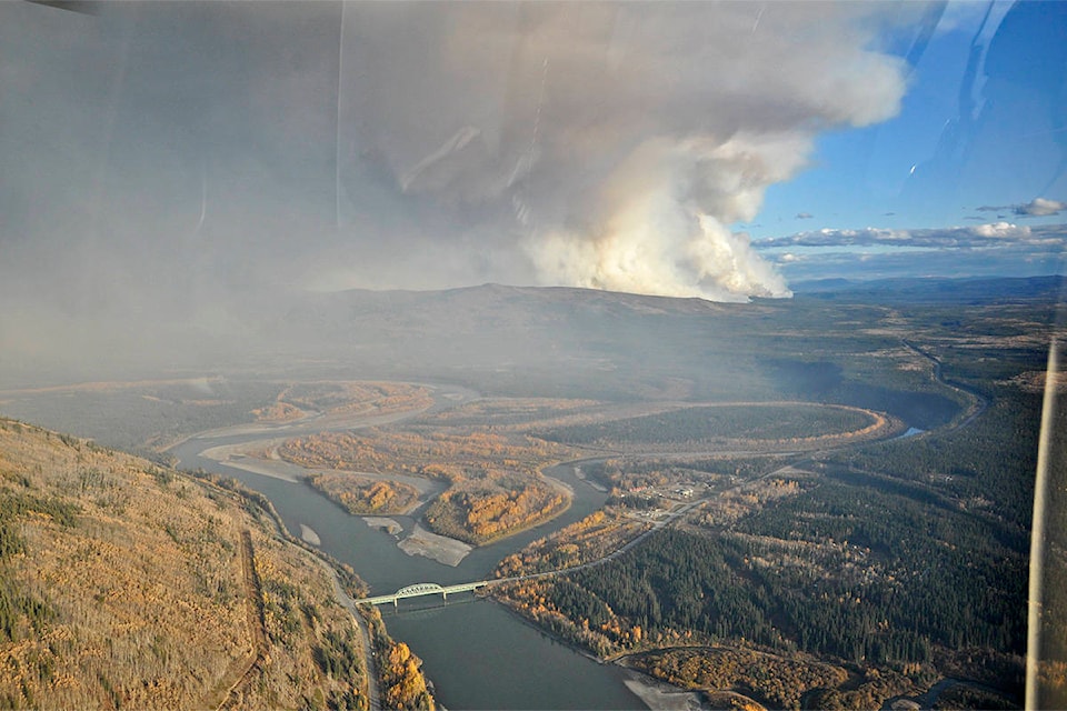
Eighteen people were evacuated from Ethel Lake, east of Stewart Crossing, to Mayo via helicopter Sept. 10 after a nearby wildfire “showed aggressive behaviour.”
According to a Yukon government fire map, the North Crooked Creek fire, located south of Stewart Crossing, had grown to 24,842 hectares as of Sept. 13 and was not under control.
Fire information officer Mike Fancie said in an interview Sept. 12 that the 18 Ethel Lake residents were moved as part of a “tactical evacuation.”
“On the day that that took place, the fire had moved quite quickly through the forest near Ethel Lake and we wanted to ensure the safety of people in the area. To do so, we helped them reach safety without waiting for an evacuation order to be issued,” he explained.
An evacuation alert issued Sept. 10 also remains in place for the area within a five-kilometre radius of Stewart Crossing. The alert also extends 12 km southeast to Ethel Lake Road, which is closed, as well as about 20 km of the Silver Trail.
The alert means that everyone in the area must be ready to evacuate within two hours of an evacuation order being issued.
Everyone affected by the alert has been contacted directly, Fancie said.
Meanwhile, 21 Wildland Fire personnel along with three helicopters and heavy equipment are on-scene trying to get the perimeter of the fire under control. A 10-person structural protection task force from the Fire Marshal’s Office, an Emergency Measures Organization officer and the RCMP are assisting the effort.
While dry, warm and windy conditions have been stoking the fire and others burning across central Yukon, Fancie said crews are anticipating a change in weather on Saturday, when temperatures are expected to drop and the wind, to die down.
Until then, people anywhere from Stewart Crossing to Mayo and Dawson City can expect to see more smoke in the air, and occasionally ash.
Fancie recommended that Yukoners looking for more information on smoke, such as where it’s originating from or how smoke from any given fire will move, check out firesmoke.ca, an online resource that maps smoke from fires across the country.
“In parts of the area closer to Stewart Crossing, there’s definitely a slight decrease in visibility in places along highway,” Fancie said. “The highway is still open and Mayo is continuing with normal life, which is good, but that being said, there is a little bit more smoke in the air.”
Contact Jackie Hong at jackie.hong@yukon-news.com