Marina McCready | Special to the News
On remote Bathurst Island in the central Arctic archipelago, there’s a national park that has seen just four visitors since its creation in 2015.
In mid-September, the cruise ship Ocean Adventurer crossed the Parry Channel to visit one of Canada’s newest national parks — Qausuittuq. The park was created primarily to protect the calving and wintering grounds of the endangered Peary Caribou herd. It would be the northernmost point of our journey at 76 degrees north.
As we approached Bathurst Island the temperature outside was -10C and we encountered newly-formed sea ice that was thin, clear and very flexible. It was interesting to watch it flex with wave action created by the ship. The zodiacs had no problem breaking through this ice and we were taken ashore to explore.
I had opted for a long hike and our route took us up a ridge made entirely of sedimentary rocks of various sizes. From the ridge we spotted both a lone muskox and a large herd across the valley and a few Peary caribou further away on the tundra. There were lots of polar bear tracks and a few places where a female bear had been digging in the snow drifts on the steep slope checking out possible denning sites. We also saw small flocks of snow buntings feeding on grass seed in the bare patches at the base of the ridge. With winter just around the corner I was amazed these little birds were still this far north. Perhaps they were just as amazed to see us.
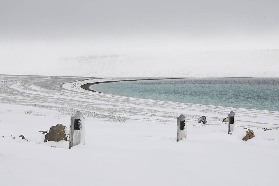
After travelling overnight through Barrow Strait, we dropped anchor off Beechey Island, a starkly beautiful and desolate spot connected by a narrow strip of land called a tombolo to Devon Island (the largest uninhabited island in the world).
Beechey is the site of three graves from the Franklin Expedition. The sailors buried here died in the first year of the expedition while the crews overwintered near this spot in 1845-46.
Beechey Island gained international attention in 1987 when Canadian forensic anthropologist Owen Beattie published a book called Frozen in Time in which he detailed how he and a team had exhumed the three bodies and performed autopsies in tents at the site. Other than elevated lead content in their bodies and evidence of lung disease, Beattie and company discovered nothing that categorically pinpointed why these three young men died so early in the expedition. Researchers speculated that traces of lead in their bodies may have come from soldering used to close the cans of food taken on the expedition.
When we went ashore it was cold, windy, and a little foggy, creating an eerie scene around the graves.
Looking around at the landscape with its massive width of stark rocky beach and backdrop of craggy rock cliffs, I was struck by the overwhelming vastness and barrenness of this location. The Franklin crews must have been saddened to bury their friends in such a hostile and alien location. One of the men buried here — John Hartnell — had a brother named Thomas on the expedition.
When his body was exhumed researchers noted John was wearing a shirt embroidered with the initials TH. It may have been the loving act of a grieving brother to use his own shirt to clothe his younger brother prior to burial. While the crew wouldn’t have known it at the time, these three who died so early in the expedition were probably the lucky ones. We now know that many of the remaining 131 men died long and painful deaths by starvation, and some even resorted to cannibalism in a last desperate attempt to survive.
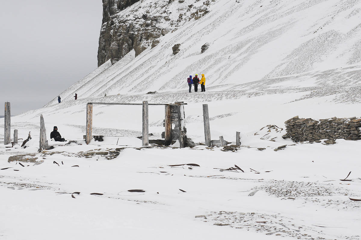
Leaving the graves, we walked down the beach about a kilometre to the ruins of Northumberland House. This structure was built from wood scavenged off a wrecked whaling ship in 1852 by the crew of HMS North Star, who were searching for the Franklin expedition. The building was stockpiled with food in case the missing crews made it back.
Time and the environment have not been kind to this structure. All that is left standing is a partial wood frame and a stone wall. Evidence of coal can still be seen where it was piled behind the building. Barrel staves, bits of cans and scraps of wood litter the ground everywhere around the ruin. When it was time to leave I dragged my feet as I slowly approached the zodiacs — taking time to examine some of the many fossils visible on the beach.
Looking at rocks containing fossilized coral and sea creatures from a southern clime juxtaposed with the desolate High Arctic environment was a surreal experience. While we had come to see historic artifacts less than 200 years old, the story here goes back millions of years to a time when this island and the tectonic plate it sits on were close to the equator before continental drift brought it all the way to this polar region.
Both the island and the men who died on it travelled a long way.
Marina McCready is a Whitehorse based freelance writer and photographer. This piece is third in a five-part series.