It’s no secret that many Yukon homes are built on permafrost.
And it’s not news that as the climate warms, pockets of permafrost are starting to thaw, causing roads and foundations to settle unevenly.
The issue came to the fore when the Ross River school was closed for several months last year due to structural damage from melting permafrost.
But now, Yukon communities have one more weapon in their arsenal to help them plan for permafrost thaw and other climate change-related risks.
The Yukon Research Centre has completed climate change hazard maps for seven Yukon communities — detailed breakdowns of the areas in each community prone to permafrost melt, flooding or landslides.
“It creates something that the communities will understand and know,” said Louis-Philippe Roy, a permafrost researcher at Northern Climate ExChange, part of the research centre.
Over six years, Roy and his colleagues produced hazard maps for Dawson City, Faro, Old Crow, Pelly Crossing, Ross River, Mayo, and Burwash Landing and Destruction Bay. High-risk areas are coloured red on the maps, while safe areas are green. Orange areas are somewhere in between.
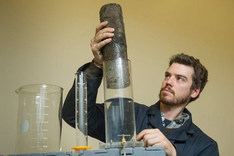
The data came from a number of sources, including aerial photos, permafrost cores and measurements of currents in the ground, which can tell researchers whether an area is frozen beneath the surface.
Roy said a number of soil features determine how susceptible an area is to permafrost melt.
“If you have … small grains, for example clay and silt, they are really small grains so they trap a lot of water,” he said.
When that water melts, it creates gaps in the soil.
“Those pockets that used to be ice are now like nothing, it’s like air, so everything on top just settles and comes down,” he explained.
Roy said that settling is what leads to bumpy ground and cracks in foundations.
Homes built beneath slopes are also at higher risk, as increasing precipitation caused by climate change can accumulate on slopes and cause landslides.
Flooding is also predicted to become more common as temperatures and precipitation rise.
“All communities that are close to waters or rivers or lakes, that can potentially be a hazard too,” Roy said.
The resulting maps are patchworks of green, orange and red. Areas near waterways, including the Mayo and the Pelly rivers, tend to be solidly red.
The researchers completed their maps in every Yukon community that was interested and that was at least partly built on permafrost. Some communities, such as Watson Lake, have no permafrost. And existing development in Whitehorse means there’s not much left in the city.
Roy said the idea for building hazard maps in the Yukon came from a researcher at the Universite de Laval in Quebec City, who created similar maps in Nunavik, in northern Quebec. But he doesn’t know of many other northern regions that have tried anything similar.
He said the researchers recently presented their research at an international conference. “I think it’s going to help a lot more people to apply it across the circumpolar North,” he said.
In the Yukon, the researchers also learned that activities like placer mining have a major impact on permafrost, because all the vegetation gets stripped away from the soil.
“This creates a big thaw, like all the permafrost thaws,” Roy said. “The vegetation does a really, really big role just in terms of keeping the thermal state of the ground stable.”
He hopes the communities will take the maps into account when planning future developments.
“Our main goal is to have our maps used,” he said.
The researchers made specific recommendations for each community. In Mayo, for instance, they suggested that future development take place higher up, out of reach of the river. In Old Crow, they recommended that new structures be built on existing gravel pads, instead of in a permafrost-rich area the community was looking at.
And in Burwash Landing, the team discovered that the ground where the community is planning to build its new wind turbines has “significant ice in it,” Roy said. In that case, engineers are going to redesign how they anchor the turbines into the ground to prepare for possible melting.
“For them to know all of this kind of really helped them out,” he said.
Roy said people should ideally build on rock where they can, instead of on permafrost. That’s not always possible, but if they know they’re in a high-risk area, they can at least build their foundations so they can be adjusted as the ground shifts.
Ian Dunlop, chief administrative officer for the Town of Faro, said most of the high-risk areas on his community’s hazard map were already deemed to “not be developable” because they were near steep slopes or in low-lying areas.
But he said the map will likely be integrated into the town’s updated zoning bylaw and official community plan.
“It just kind of increases awareness of what some of the hazards of climate change are,” he said. “We obviously can’t ignore the impacts, even though they’re not necessarily things that are within our control.”
Contact Maura Forrest at
maura.forrest@yukon-news.com